Hurricane Season 2022 – Wullie Davidson

Wullie Davidson’s Blog: June, 2022
It’s now officially hurricane season. June 1st is the official starting date of the Atlantic hurricane season. In the eastern Pacific, tropical cyclones are also called hurricanes, and the official starting date there is May 15. In the Indian Ocean, and south west Pacific, they are called cyclones, while in the north west Pacific, they are known as typhoons. The north west Pacific is the most active region in the globe, as the residents of the Philippines will attest to.

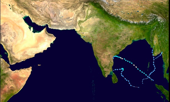
North Indian Ocean Cyclone Season
Many factors combine to produce a hurricane, but warm sea surface temperatures (SSTs) are most important, which is why the strongest Atlantic hurricanes tend to occur in late August and September, when the sea is at its warmest. It has long been predicted that tropical cyclones would increase in both strength and numbers as global warming progressed, but the evidence for this is, so far, not strong – except in the Atlantic. Here, there has been an increase in both intensity and frequency, in recent years, and there is also evidence that hurricanes are spreading northwards, potentially affecting cities that were only rarely struck in the past, such as New York City.
The 2021 Atlantic hurricane season was the third most active on record., with 21 named storms, 7 of which were hurricanes and 4 of these were major hurricanes, of category 3 (111 mph) or higher. There were 194 fatalities, and $80.7 billion in damages, making it the third costliest season on record. Hurricane Ida accounted for $75 billion of the total.
2020 – The Most Active Hurricane Season on Record

Destruction. Aerial view of part of Roseau, the capital city of Dominica https://www.flickr.com/photos/dfid/37361025335/
2020 was the most active year on record, surpassing 2005, the year of Katrina. There were a record 30 named storms, 14 hurricanes, and 7 majors. An average season has 14 named storms, 7 hurricanes, and 3 majors. 2017 was the costliest hurricane season on record, with $295 billion in damages, and 3,369 fatalities, most of them in Puerto Rico, after hurricane Maria hit as a category 5, with 175 mph winds. Hurricane Harvey made landfall in Texas as a category 3, with 130 mph winds. It then stalled for a few days, dumping five feet of rain on Houston. Damage has been estimated at $125 bilion, second only to Katrina. Hurricane Irma was another category 5 monster, with 180 mph winds in the Caribbean, before weakening to a borderline category 2/3, as it travelled up the length of Florida, causing $77 billion in damages.

la nina temperature anomalies
The past two years of increased Atlantic hurricane activity have coincided with two years of La Nina in the Pacific. La Nina is the cool phase of the El Nino Southern Oscillation (ENSO), with El Nino being the warm phase. Atlantic hurricane activity tends to be enhanced during La Ninas, due to the fact that there is usually less wind shear to inhibit hurricane formation. Wind shear is just different wind speeds and directions in different levels of the atmosphere. When shear is strong, cyclogenesis is inhibited, and any tropical storms that manage to form can be dissipated. La Nina is still with us, and is expected to continue for a third year. Partly because of this, the US National Hurricane Center is predicting a particularly active season in 2022. The Colorado State University hurricane forecasting team is predicting 20 named storms, 10 hurricanes, and 5 majors. This is an unusually strong prediction. Scientists are normally a conservative bunch, so it’s a big red flag when they go out on a limb like this. However, over the years, I’ve developed a healthy scapticism for these early season predictions, as they’re often wide of the mark. That said, I do expect an above average season.
Hurricane Agatha

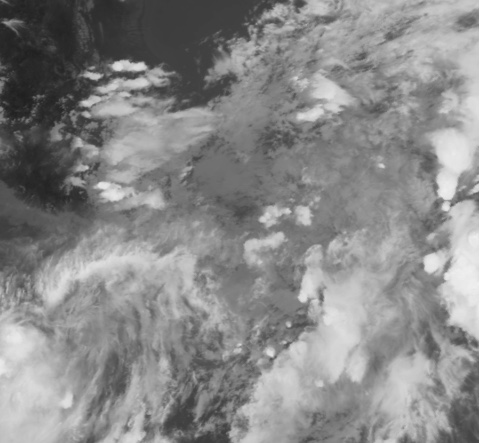
Hurricane Agatha https://www.nrlmry.navy.mil/TC.html
On May 30th, the eastern Pacific hurricane Agatha made landfall on western Mexico, as a 105 mph category 2 hurricane, just 6 mph short of category 3 major status. Very early assessments put the death toll at 11, with 32 missing. These numbers will certainly increase. Agatha was the strongest landfalling eastern Pacific hurricane, this early in the season. Agatha has now travelled across Mexico, and is starting to merge with a broad area of convection off the eastern edge of the Yucatan peninsula. This has been designated as invest 91L, by the NHC, which means that there is a good chance that it will develop into a named storm. However, there is currently 25-35 mph of wind shear, which will suppress development. It is expected to develop into tropical storm Alex, probably with wind speeds of less than 60 mph, and bring several inches of rain to Florida.
Wullie Davidson, 2 June, 2022
This section: COP26 Glasgow, Climate Change, Save the Planet, Science, Biodiversity Events, Pat's Home Page Blog, Science: Climate Change and Other Topics
Related Pages
- Paintings on Railings at West Fest
- Children’s Walk for Gaza, Glasgow Green
- WestFest 2026: Full Programme Announced
- National Theatre Live: All My Sons
- W. Davidson Climate Change Blog: Super El Nino on the Way?
- Responding to Alasdair Gray’s ‘Lanark’ University of Glasgow
- Could you open your home and heart to a guide dog puppy, and help change a life?
- Heidi Talbot, Paisley Arts Centre
- Broken English – GFT
- Helen Rose Outdoor Diary: Cairneyhill to North Queensferry
- Hinba Bakery Hyndland – Expansion Plans
- Glasgow Merchant City Festival 2026
- When Billy Met Alasdair
- Byres Road Community Hub Day: A Prescription for Change
- Earth’s Greatest Enemy film review Pat Byrne
- The Kelvin: Restaurant, Bar, Wedding and Events Venue
- Glasgow Shopping: Currie and Quirk Opticians, Byres Road, G12
- Mermaids at GFT – Mother’s Day
- Effi O Blaenau review Pat Byrne – Glasgow Film Festival 2026
- Glasgow Film Theatre Announces Programme for March 2026


