Helen Rose’s Outdoor Diary: The Whangie October 2020
The Whangie
As lockdown continues due to the Covid 19 virus, it has been fortunate that walking clubs can continue to programme walks as being outdoors in the fresh air is so important during these terrible times including for both mental and physical health. The HF Outdoor Club organised a walk to the Whangie and Burncrooks Reservoir. This area is in Stirlingshire into the Kilpatrick Hills in West Dunbartonshire. It is only about 40 minutes’ drive from Glasgow and to the south of the Campsie Fells. The walk starts from Queens View car park which is just past the hamlet of Carbeth where there used to be the Carbeth Inn, famous for being a gathering place of bikers but it closed some years ago.
Auchineden Hill
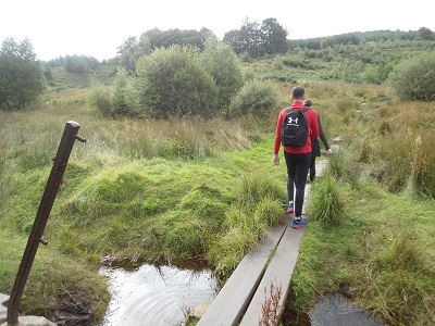
Many years ago I did these walks from the Queens View car park. I assume the name of Queens View is named after Mary Queen of Scots who possibly is alleged to have admired the view. It is a lovely view from the Valley to the Campsie Fells to the north and the Kilpatrick Hills to the south. From the car park there is a stile and a burn to cross and helpfully there are now boards to walk on over the boggy path. Many boots have walked up these hills but we did pass some people in lovely white trainers and wondered how they would cope with the muddy paths!
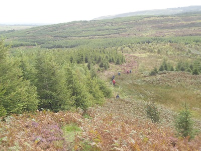
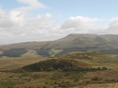
We gained height on a good path and skirted around the Whangie and up to Auchineden Hill where there is a Trig Point. Here we had a refreshment stop with good views overlooking the hills. We looked out as far as Ben Lomond, the most southerly Munro (mountains over 3,000 feet). Fortunately, it was windy so there were no midges – the bane of walker’s lives. Midges are tiny flying insects with a wingspan of only 2-3mm. There are over 35 different species of biting midge in Scotland, but it is the Highland Midge that earns its place as Scotland’s most ferocious foe. They hang about in swarms and the only deterrents are wind and smoke.
Heather
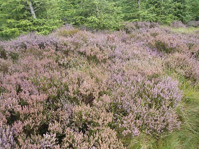
Heather grows freely and abundantly spreading its glorious purple colours across around five million acres of Scottish moorland, glens and hills. The most common type of heather in Scotland is ‘Ling’ heather which is hardy and fast growing and loves wet soil. With all the rain we get north of the border it is one very happy little plant! We walked alongside the heather on the path. It is a lovely purple/lilac colour and often the colour is used in Scottish tartans. It blooms in late summer and makes it a great time to be out and about. When the Queen officially opened the Scottish Parliament, she wore a heather coloured outfit to signify the national flower. Heather honey from bees is considered the best in Scotland.
During the walk, we encountered two obstacles as well as having to climb over the usual stiles. The first was at a gate which had a deep muddy path in front of it but a narrow plank of wood had been laid across it which was like walking a tight rope but a fall to the side would have meant a mud bath! The second obstacle was having to do a limbo dance under a broken fence as the treads of the stile over the high deer fence were broken. Unfortunately, I did not take photos as we were too busy trying to reach the other side in both instances. Mud is not unusual in Scotland and walkers often wear gaiters to keep their trousers clean above the boots.
Burncrooks Reservoir
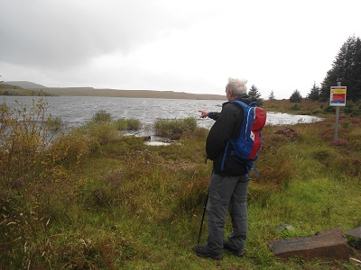
Burncrooks reservoir is a man-made body of water that offers a picturesque walk as part of the John Muir Way between Balloch and Strathblane. It is a feeder to Milngavie Waterworks which serves Glasgow for water. Scottish water is soft and pleasant to drink. Hard water has chalk or limestone rocks but they are not common in Scotland so most water supplies are classified as soft.
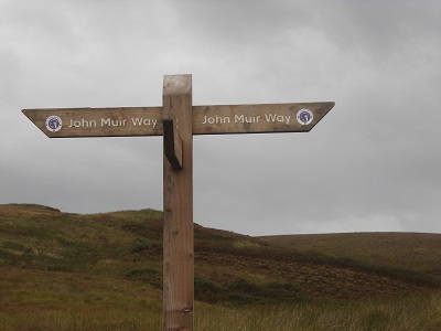
We walked around the Reservoir and found a spot with a good view to have lunch. The walk included part of the John Muir Way which runs from Helensburgh in Argyll and Bute in the west to Dunbar, East Lothian in the east. It is not to be confused with the John Muir Trail in California running through Yosemite Park! John Muir came from Dunbar and was the founder of the National Parks in the US. It is only fairly recently that the John Muir Way was established in central Scotland. Many trails and paths cross in central Scotland with the creation of so many walkers paths.
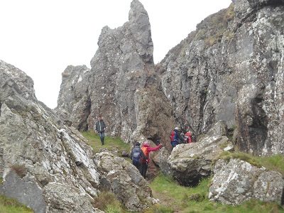
The Whangie
We walked up to the Whangie which is a fascinating geological fault, 50 feet deep and 300 feet long. We climbed up a worn rocky slope to enter the massive gash in the rock. You can walk all the way through this narrow cleft, divided from the open air by a wall only a few feet thick on the left side. The walls of the Whangie have been used as a training ground for generations of rock climbers. Another path keeps to the left and stays outside the Whangie and shows the full height of the narrow outer wall. Local legend explains the Whangie’s creation when the devil was holding a meeting with witches and warlocks on the Campsies one day, and the Whangie was created when he playfully whipped his tail across the summit of Auchineden Hill. It was a good path back to the car park.
Scarecrow
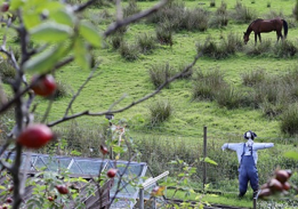
On a previous walk nearby, we passed a very impressive scarecrow on a fence of some allotments. In Scotland we call scarecrows, Tattie Bogles. It basically means a folkloric being in a potato field!
Thanks to Charo for the photo of the scarecrow.
Forthcoming attractions. River Clyde and Rouken Glen Park
This section: Helen Rose Hillwalking Diary, Pat's Home Page Blog
Filed under: Helen Rose Hillwalking Diary, Pat's Home Page Blog
Prevous page or post | Next page or post
Written by : Helen Rose
![]() Scottish hill walker and writer for Pat's Guide to Glasgow West End.
Scottish hill walker and writer for Pat's Guide to Glasgow West End.
Related Pages
- ‘Premature’: First clip released from brand new Scottish rom-com
- Glastonbury The Movie -30th Anniversary at GFT
- Helen Rose’s Outdoor Diary: St Monans to Kingsbarns.
- Maryhill Festival 2026
- Fiona Alderman: Fires, markets and the 14th July
- Ray Harris and Special Guests at Cottiers
- Spiral Scratch – Kevin Gilday New Material plus Open Mic
- Off the Beatson Track Fundraiser
- The Man Who Wasn’t There – 4K at GFT
- Bangla Mela, Celebrating Commonwealth Games 2026
- Overhaul Live in Store, LNFG
- All Elements Scottish Hip Hop Jam 2026
- Terry Neason Songs and Words, Òran Mór
- tell it slant at Locavore
- Commonwealth Community Festival
- Alasdair Gray Archive – Matthew Arthur Williams: Holding Ground
- Wullie Davidson Bus Pass Rambles: Walk to Steall Falls in Glen Nevis
- Going for Gold: Young Talent 2026 at ProjectAbility
- Arepas for Venezuela – Fundraiser
- Take 2: Muppet Treasure Island at GFT