St Monans to Kingsbarns. August 2026.
Helen Rose Outdoors
The Glasgow HF Outdoor Club https://www.meetup.com/glasgow-hf-outdoor-club/ are completing the Fife Coastal Path this year. We recently did two sections of it over two Saturdays. There are 13 sections in total and JP and Eileen have done a fantastic job of organising and leading each section. The logistics were difficult as these are linear walks and have involved car shuttling and public buses at times. This blog is a combination of two sections, St Monans to Crail and Crail to Kingsbarns.
Pittenweem
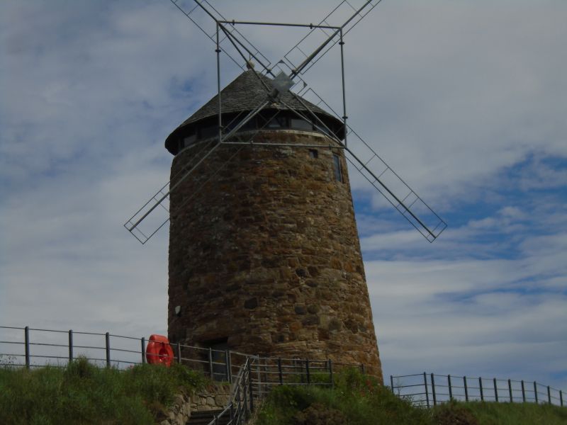
We walked from St Monans where we finished the previous section and passed the Saltpan which is the only windmill left in Fife and walked to Pittenweem. Such an interesting sounding name. The name derives from Pictish and Scottish Gaelic. “Pit-” represents Pictish pett ‘place, portion of land’, and “-enweem” is Gaelic na h-Uaimh, ‘of the Caves. It is a charming fishing village. The town of Pittenweem was first created into a burgh by James III.
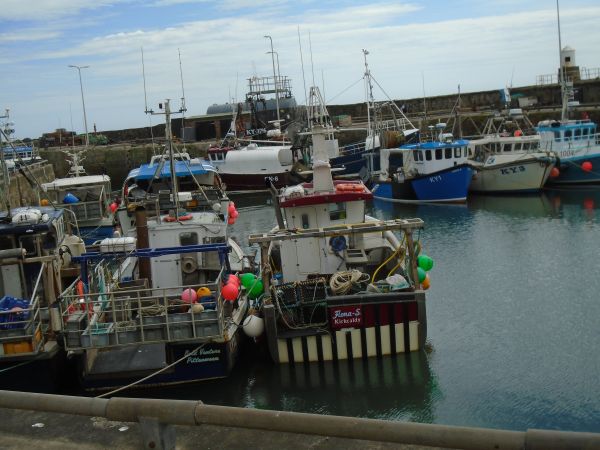
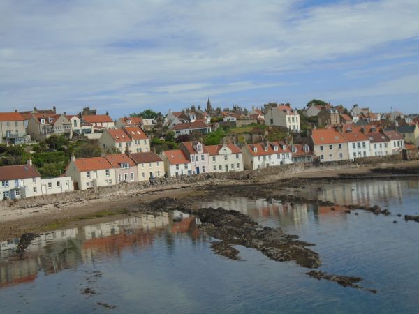
The town, with its picturesque white houses and red roofs in the classic East Neuk style, clusters around a small circular harbour. The harbour itself is home to one of Scotland’s last active fishing fleets, and a busy fish market is held almost every weekday morning. Erection of the breakwaters began in the 16th century. The prominent tower on the outer pier was added much later in 1865.
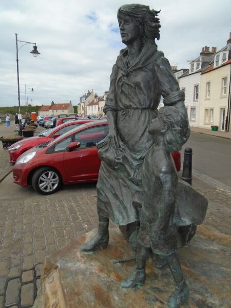
The Pittenweem statue, known as the Pittenweem Fishermen’s Memorial, is a bronze sculpture located on the shore near the fish market at the Harbour
Crail
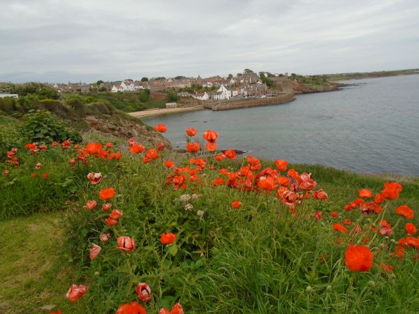
After leaving Pittenweem we continued on the coastal path and eventually there was a lovely view looking down to Crail through a sea of poppies. The name Crail was recorded in 1148 as Cherel and in 1153 as Karel. The first element is the Pictish cair (Welsh caer) meaning “fort”though this word seems to have been borrowed into Gaelic. Crail is a very attractive East Neuk town as this part of Fife is known
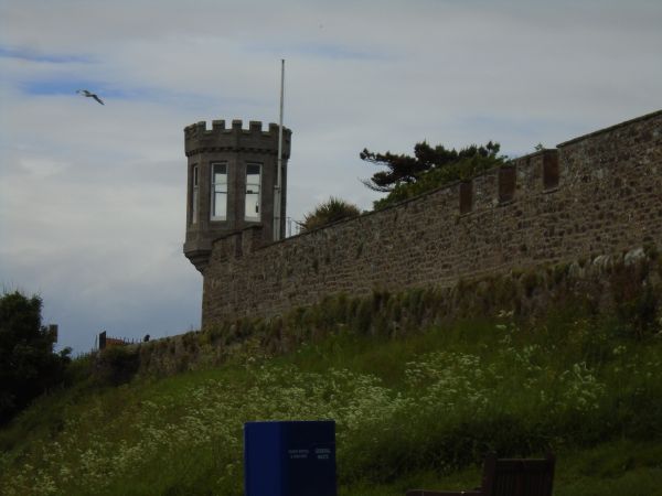
There is an interesting wall and tower when leaving Crail heading down to the beach and the coastal path.
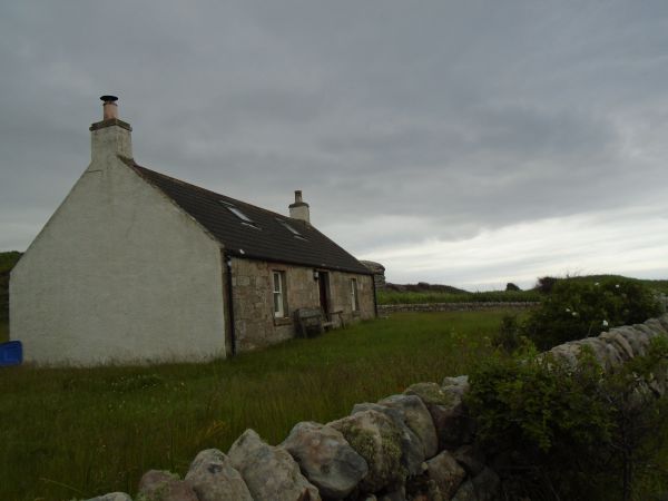
We walked from the town passing a lovely old cottage with a great sea view.
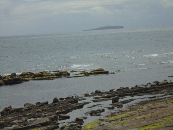
We could see over to the Isle of May over the beach. It is a nature reserve and has puffins nesting there in season. I wrote about it previously in 2016. https://www.glasgowwestend.co.uk/isle-may-2016/
St Constantine’s Cave
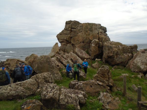
We had lunch at a sheltered large rock at the sea as there was a cool wind. The choice was to sit on the grass with a sea view and less sheltered or to coorie in under the rock where it was cosy. Coorie is a traditional Scottish word meaning to snuggle, cuddle, or nestle for warmth and protection.
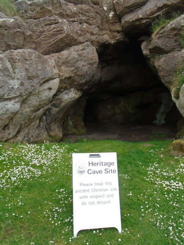
We walked on to the St Constantine’s Cave which is a shallow cave but you can walk inside it. Local legend suggests that King Constantine I was killed by the Vikings here in AD 877, although this is thought to be untrue. There are crosses and animals carved on the walls, suggesting use in the early Christian times. An excavation in 1914 revealed ancient antler and bone fragments, evidence of iron smelting and pieces of Roman jars possibly salvaged from a wreck in the 1st century AD. In 1812, with the fear of French invasion, a group of Fifeshire Volunteers are said to have used the cave as an observation post.
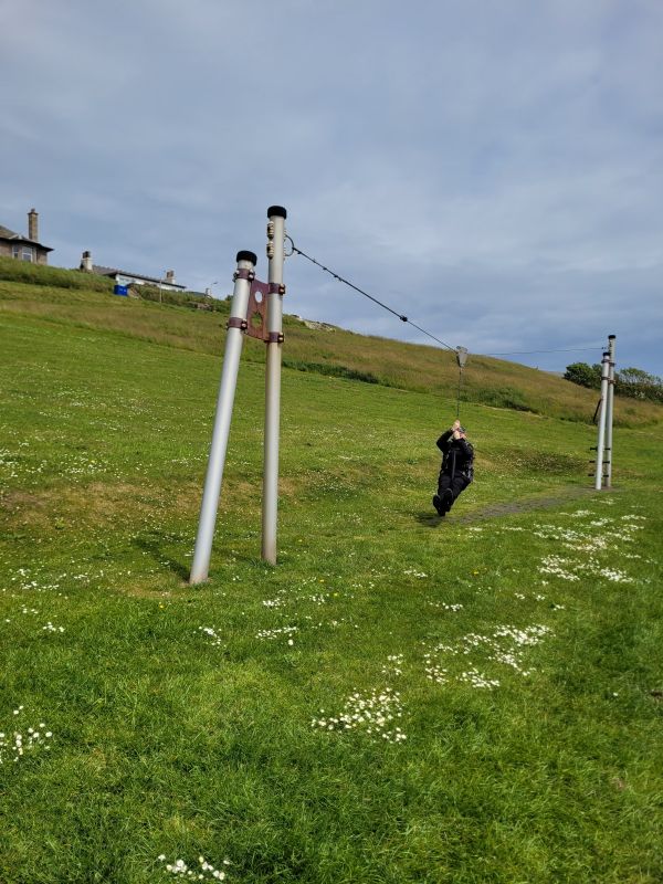
Walking on further we came to a playground and some of the ‘big kids’ could not resist a shot on the zipwire.
Rock Strata
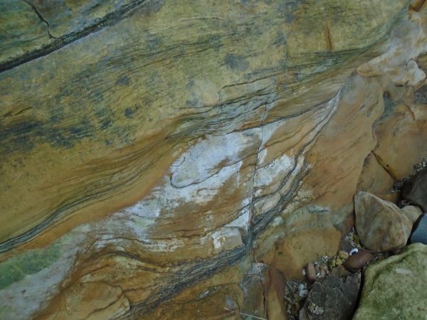
On our way to Kingsbarns I noticed some interesting rock strata. The rock strata near Kingsbarns features Carboniferous sedimentary layers, prominently displaying alternating sandstone and shale, soft-sediment folds, and ancient plant fossils. These coastal outcrops formed roughly 335 million years ago in a vast delta system. Laid down approximately 330 to 335 million years ago during the Visean stage of the Carboniferous period when Scotland sat near the equator in a humid, swampy environment. It gave the rock an interesting colour and pattern.
Kingsbarns
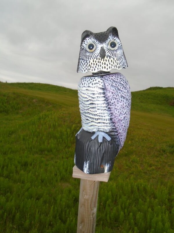
We walked along by the golf course and noticed a wooden owl on a post which was nodding as it had a wire construction. It is always good to see a fun object on our walks and gives us a talking point.
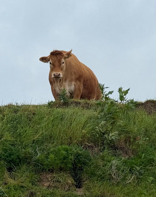
Past the golf course, the coastal path was blocked by cows with calves. The calves tend to be curious and approach humans but the cows can feel there is a threat and take action so best to avoid the herd. We walked along the beach rather than the path which was very pleasant on the sand. We reached Kingsbarns where the cars were parked to shuttle back to collect the cars at the starting point.
A big thankyou to JP and Eileen for organising the Fife Coastal Path Sections
Coming attractions; Falkland. Tentsmuir and Arrochar Historical Trail.
This section: Helen Rose Hillwalking Diary
Filed under: Helen Rose Hillwalking Diary
Written by : Helen Rose
 Scottish hill walker and writer for Pat's Guide to Glasgow West End.
Related Pages
- St Monans to Kingsbarns. August 2026.
- Helen Rose Outdoor Diary: Elie Chain Walk.
- Helen Rose Outdoor Diary: Aviemore Again.
- Helen Rose Outdoor Diary, Fairlie
- Helen Rose Outdoor Diary: Cairneyhill to North Queensferry
- Helen Rose Outdoor Diary: Busby to Eaglesham
- Helen Rose’s Outdoor Diary: Roman Barr Hill and Croy Hill.
- Ayrshire Coastal Path. Final Sections. November 2025
- Helen Rose’s Outdoor Diary: Glasgow Cathedral and Necropolis
- Helen Rose’s Outdoor Diary: Royal Edinburgh Military Tattoo
- Helen Rose’s Outdoor Diary, Alnmouth, Northumberland
- Helen Rose’s Outdoor Diary: Braemar
- Helen Rose Outdoor Diary: Robert Burns Country
- Helen Rose’s Outdoor Diary: Cademuir, Peebles.
- Aviemore – Helen Rose Outdoors
- Helen Rose’s Outdoor Diary: El Rompido Part 2.
- Helen Rose’s Outdoor Diary, El Rompido Part 1.
- Helen Rose Outdoors – Grantown on Spey.
- Helen Rose’s Outdoor Diary: Edinburgh.
- Helen Rose’s Outdoor Diary – St Andrews from Kingsbarns