Helen Rose’s Outdoor Diary: Neilston to Darnley
March, 2023
Neilston
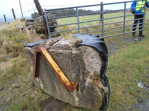
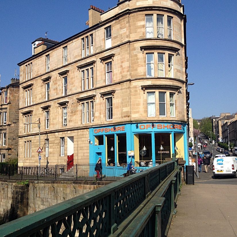
On a winter walk I went with Glasgow Ramblers from Neilston to Darnley. From Glasgow City Centre we took the train to Neilston, which is in the south west of the Greater Glasgow conurbation. Neilston is mentioned in documents from the 12th century, when the feudal lord Robert de Croc, endowed a chapel to Paisley Abbey near Neilston. Darnley is in the Glasgow area so we crossed the boundary into Glasgow. I continue to be amazed at the interesting places that are easily accessible from the Glasgow area where I live. The highlight of the walk was to the Craigie. At the start of the fields, there was a very impressive block of stone with a tractor tyre on it to keep vehicles from entering the fields.
Craigie and Duncarnock Fort
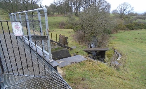
On the route to the Craigie we had to cross a burn, (Scottish for a stream) on a metal bridge made of hollow squares of metal, which would have been difficult for a dog to walk across, so a small wooden bridge lower down was provided for the dogs or perhaps it existed before the new bridge! We were wearing hiking boots so had no problem on the metal bridge.
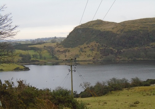
Duncarnock Fort is known locally as The Craigie. The remains of a fort probably occupied in later prehistory between 1200 BC and AD 400 and perhaps reused between AD 400 and AD 700. The fort occupies a broad hilltop with a rocky knoll at the NE end. A single terraced rampart of earth and stone extends around the crest of the hill and an inner defence may have provided additional protection for the knoll. The sides of the hill are extremely steep, particularly to the north-west where cliffs descend to the Glanderston Reservoir below. As it is a craggy hill we took the easier path to the top which Sandra, our leader, referred to as the Granny and Grandpa path so named by her grandchildren! It is 204 metres/ 669 feet high so a little stretch of the legs. It was a fairly clear day so we paused on the summit, just as Mary Queen of Scots is rumoured to have done and enjoyed the views over Glasgow to the Campsie Hills in the north.
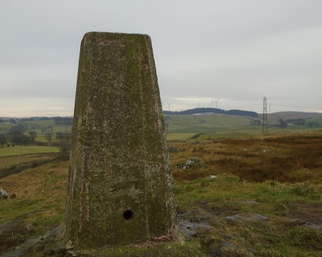
There are no visible remains of the Fort but there is a trig point on the summit. Trig points are the common name for “triangulation pillars”. These are concrete pillars, about 4 feet tall, which were used by the Ordnance Survey in order to determine the exact shape of the country. They are generally located on the highest bit of ground in the area, so that there is a direct line of sight from one to the next. By sitting a theodolite (an accurate protractor built into a telescope) on the top of the pillar, accurate angles between pairs of nearby trig points could be measured. This process is called “triangulation”.
Reservoirs
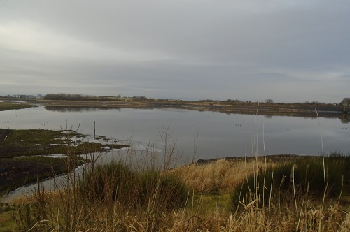
We descended the hill and walked away from Glanderston Reservoir towards Balgray Reservoir that had been almost drained with the outer parts showing as mud flats. It has been slowly draining over several years to carry out essential maintenance. At Barrhead Reservoir nearby, the plug had been pulled to prepare the way for a new Wakeboarding and Water sports Centre. Wakeboarding is drawn from snowboarding and skateboarding and is a fast growing sport.
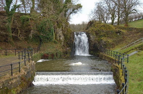
This area with its four reservoirs is great for spotting bird life and we saw swans, geese, many ducks – mallard, tufted and goosanders. On the walk we passed a waterfall, which was the water from the Brock Burn feeding the reservoirs. Reservoirs can be created in a number of ways, including controlling a watercourse that drains an existing body of water, interrupting a watercourse to form an embayment within it, through excavation, or building any number of retaining walls or levees.
Dog Park
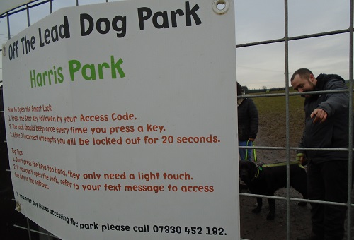
We walked on and came to the Dog Park. This is a fairly new concept here where dogs are set loose in enclosed fields and allowed to run around. There were even little jumps for them like a dog gymkhana. A shelter was provided for the owners to stand and watch the dogs having a good time and presumably to control the dog s if a fight were to break out.
The dogs were very excited at the entrance gate knowing fun was in the fields. We had lunch at picnic tables nearby.
Dams
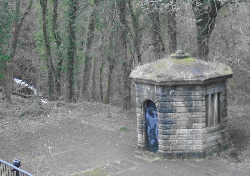
The walk was linear so we headed away from the reservoirs and came to the dams. There was a curious little circular building and I was advised it was the place where the dams were controlled. Dams to Darnley is a Country Park and has a rich and varied history. From the farms which likely date back to medieval times, to the Darnley bleachfields, which influenced the industrial landscape of the west of Scotland and beyond, right up to the prisoner of war camp at Patterton. Over 400 years of history can be documented across the landscape of the country park.
Waulkmill Glen
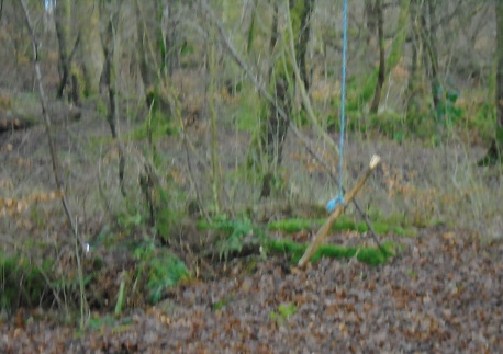
After leaving the dams, we walked through Waulkmill Glen – made up of semi-natural valley woodlands along the steep sided ‘glen’ and policy plantation woods leading up to the upper slopes. Towards the north the woodland becomes more open and has several large mature trees which were part of the designed landscape of Darnley House. Waulkmill Glen is rich in biodiversity with many woodland flora species recorded.. It will be carpeted with bluebells in the spring. There was a swing hanging from a tree made of a piece of wood on a rope but nobody was brave enough to try it out! It was along to Priesthill and Darnley station to catch the train back to Glasgow.
A big thank you to Sandra for leading this walk of about 8 miles and a thousand feet of ascent with interesting features. Also to Glasgow Ramblers who continue to offer walks that are new to me and in lively company.
This section: Helen Rose Hillwalking Diary, Walks
Filed under: Helen Rose Hillwalking Diary, Walks
Prevous page or post | Next page or post
Written by : Helen Rose
![]() Scottish hill walker and writer for Pat's Guide to Glasgow West End.
Scottish hill walker and writer for Pat's Guide to Glasgow West End.
Related Pages
- Helen Rose Outdoor Diary: Elie Chain Walk.
- Helen Rose Outdoor Diary: Aviemore Again.
- Helen Rose Outdoor Diary, Fairlie
- Helen Rose Outdoor Diary: Cairneyhill to North Queensferry
- Bob Law: Heads of Ayr to Dunure Coastal Walk
- Helen Rose Outdoor Diary: Busby to Eaglesham
- Helen Rose’s Outdoor Diary: Roman Barr Hill and Croy Hill.
- Ayrshire Coastal Path. Final Sections. November 2025
- Helen Rose’s Outdoor Diary: Glasgow Cathedral and Necropolis
- Helen Rose’s Outdoor Diary: Royal Edinburgh Military Tattoo
- Helen Rose’s Outdoor Diary, Alnmouth, Northumberland
- Helen Rose’s Outdoor Diary: Braemar
- Glasgow Botanic Gardens – Tour the Kibble Palace
- Helen Rose Outdoor Diary: Robert Burns Country
- Helen Rose’s Outdoor Diary: Cademuir, Peebles.
- Aviemore – Helen Rose Outdoors
- Helen Rose’s Outdoor Diary: El Rompido Part 2.
- Helen Rose’s Outdoor Diary, El Rompido Part 1.
- Helen Rose Outdoors – Grantown on Spey.
- Helen Rose’s Outdoor Diary: Edinburgh.