


Navigation on Creag Pitridhs October 2005
Helen Rose Hill Diary
 Navigation on mountains is not my strong point and I generally hill walk with people who navigate but I do try sometimes to practice navigation. All walkers should take responsibility on mountains especially if walking in a small group. I have been on courses on navigation in various clubs over the years and I am fine in theory but when it comes to practice, that is another story. I can navigate my way fine with a map and compass in a thick mist with the backup of the GPS to determine exact position but I am not good on a clear day at looking around and deciding how to proceed as I find it difficult to relate the features on the map to the terrain. I must be lacking in spatial awareness! If I am navigating, I tend to follow the route in the Munro book to the letter and this may not always be the best route as I discovered on An Socach at Glenshee where the book advises starting from the ski centre and climbing towards Loch Vrotachan and then losing height over rough ground with a burn to cross. All this can be avoided by starting further along the road and taking a landrover track from Baddoch to the base of the mountain. This can easily be worked out by reading the map and by looking at the alternative route in the book!
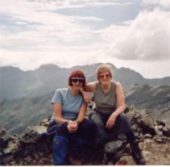
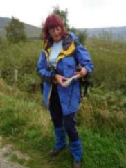
Noreen and I decided over a weekend recently to bag the three mountains known as the Creag Pitridhs. We had intended to do them in one day but the weather was foul, thick mist and wet so we managed two and returned the next day to climb the third one. The disadvantage here was having to do the same long walk on the winding landrover path on two consecutive days. However, it was an interesting experience as the second day was fine, sunny weather and we were able to see the route we had taken the previous day and how complicated the navigation was on these hills.
 We followed the route from the SMC Hillwalkers Guide Munro book and I had copied the page so that we could refer to it if necessary.
When we set out on the first day, it was dry but the mist was down to about 1,000 feet. We followed the winding path from near Moy for about five miles under Beinn a?Chlachair eventually along a burn to the north of the mountain. From the map, the track we were on carried onto a col between Beinn a?Chlachair and Geal Charn and this would have made a longer ascent up to Beinn a?Chlachair so we crossed the burn and took a compass bearing on the map as we could not see the ridge for the mist. We followed the bearing onto the ridge. So far, so good, but the ridge was long with a steep drop so we checked the GPS for exact position and then took another bearing from the map to take us to the cairn. Visibility was down to a few feet in the thick mist. We met other people also looking for the cairn and surprisingly, one couple remembered meeting us on the top of Ben Alder a few months ago. The cairn was not easy to find and we lost on the time estimated by the book. We descended on a bearing to the col but here it was tricky as the path ended in a steep drop over rocks so we found a way around them and another path descending to a stalkers track. On the stalkers track, we were tempted to turn right but we consulted the map and GPS again and realised this was not the route to take although intuition said it should be. When navigating in a thick mist, it is never wise to follow intuition or paths unless you know where they are going from the map.
We followed the route from the SMC Hillwalkers Guide Munro book and I had copied the page so that we could refer to it if necessary.
When we set out on the first day, it was dry but the mist was down to about 1,000 feet. We followed the winding path from near Moy for about five miles under Beinn a?Chlachair eventually along a burn to the north of the mountain. From the map, the track we were on carried onto a col between Beinn a?Chlachair and Geal Charn and this would have made a longer ascent up to Beinn a?Chlachair so we crossed the burn and took a compass bearing on the map as we could not see the ridge for the mist. We followed the bearing onto the ridge. So far, so good, but the ridge was long with a steep drop so we checked the GPS for exact position and then took another bearing from the map to take us to the cairn. Visibility was down to a few feet in the thick mist. We met other people also looking for the cairn and surprisingly, one couple remembered meeting us on the top of Ben Alder a few months ago. The cairn was not easy to find and we lost on the time estimated by the book. We descended on a bearing to the col but here it was tricky as the path ended in a steep drop over rocks so we found a way around them and another path descending to a stalkers track. On the stalkers track, we were tempted to turn right but we consulted the map and GPS again and realised this was not the route to take although intuition said it should be. When navigating in a thick mist, it is never wise to follow intuition or paths unless you know where they are going from the map.
By this time, it had started to rain but we estimated we had enough daylight to bag the second Munro so we followed the path rising up to the col between Geal Charn and Creag Pitridh which we left to strike uphill towards the top after we were confident we were clear of the rocky outcrops described in the book and shown on the map. A word of warning here, rocky outcrops are not always in the exact position on the map. We navigated to the top on a compass bearing which we checked regularly with the GPS. It was difficult as there were ascents and descents on top of the mountain before we reached the cairn. Throughout all of this, we were confident on the navigation and although it was wet, the weather was mild. We descended the second Munro but as there was a long walk out, we decided to leave Creag Pitridh to the following day. On the track we met other walkers and on chatting to them, we were aware that their navigation skills were poor so another important point to remember is never trust other walkers you meet on a mountain to lead you unless you are confident they know what they are doing. I have referred to the GPS but in the event of a technical failure, it would be necessary to pinpoint position using the means available such as relating features around and steepness etc to contour lines on the map.
When we returned the following day, the route looked so easy in clear weather. It is essential to ensure you allow extra time in poor conditions to avoid having to descend in darkness and worsening weather. We had torches with us but more important to us was getting to the pub before they stopped serving food!
Coming attractions; Cairngorms, Arran again and a walk in Hong Kong.
Contact me at helenrose52@hotmail.com
Thanks to Frances Rickus for the photos